Our Fleet & Field Gear
Institutional-grade data on a public school budget.
We believe students learn best when they know exactly where their data comes from. We don’t use sterile, computer-generated models or $15,000 black-box marine instruments. Headwaters & Marine Stewards utilizes a lean science operational model—deploying rugged, open-architecture, and affordable tools to capture survey-grade environmental data.
Here is the three-tier hardware system that powers our Ridge-to-Reef curriculum.
1. Surface Ops: The Workhorse
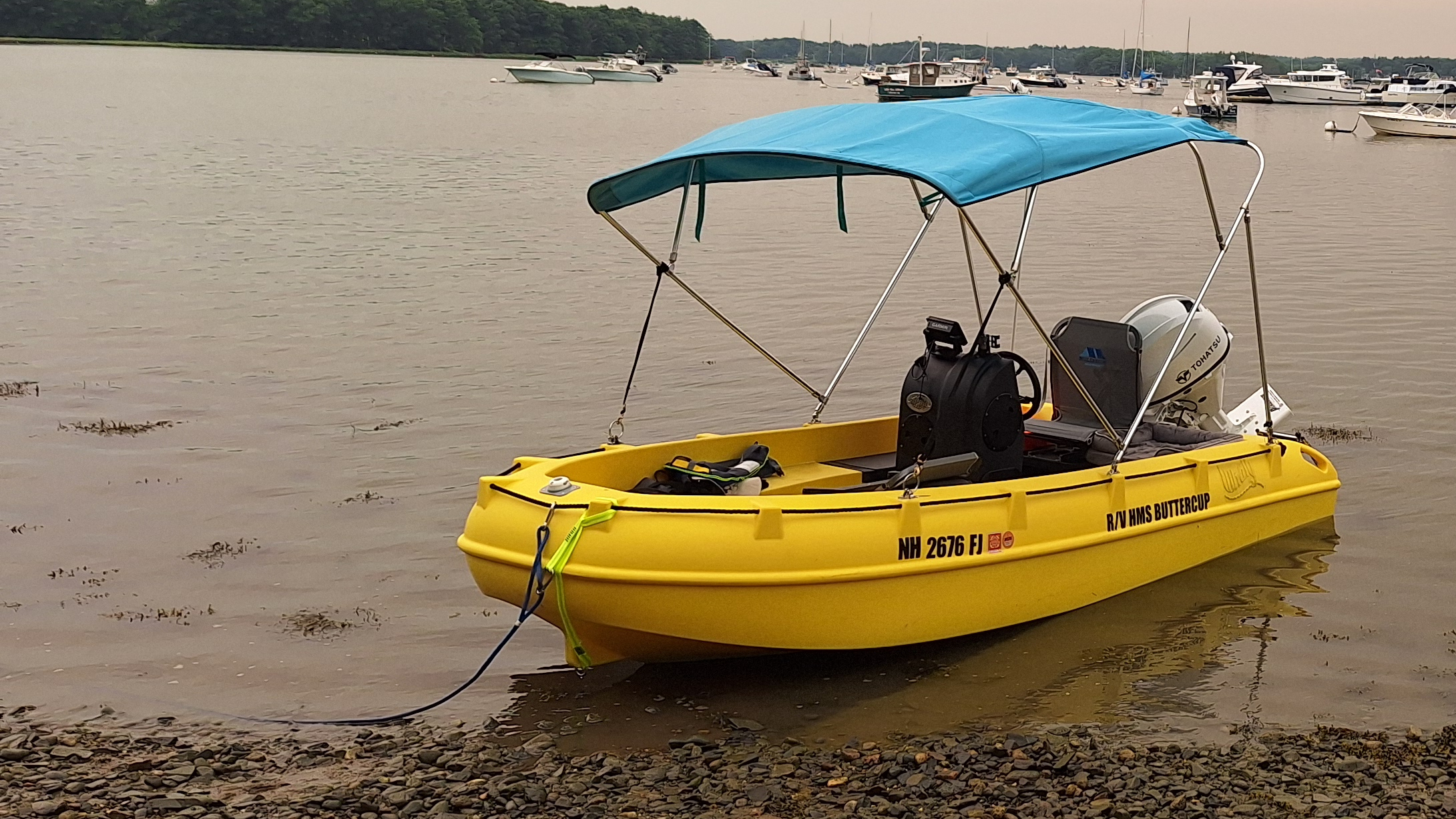
R/V HMS Buttercup
- Platform: Whaly 380 High-Density Polyethylene (HDPE) Skiff
- Propulsion: 30HP Tohatsu MFS30D EFI 4-Stroke (Ultra-Low Emission)
- Status: Active Deployment
The Buttercup is our primary crewed research vessel. Built from double-walled, rotomolded polyethylene, it functions as an unsinkable, impact-resistant mobile lab platform designed specifically for near-shore and estuarine work where traditional fiberglass research boats cannot go.
- Extreme Shallow-Water Access: Operates in as little as 8 to 10 inches of loaded draft, allowing crew to sample directly inside discharging stormwater culverts, tidal mudflats, and shallow marsh banks.
- Low-Impact, High-Efficiency Propulsion: Powered by a lightweight 3-cylinder Tohatsu outboard featuring battery-free electronic fuel injection (EFI) and through-the-prop exhaust, reducing acoustic disturbance in sensitive wildlife habitats while exceeding EPA & CARB 3-Star Ultra-Low emission ratings.
- End-of-Life Sustainability: The hull is 100% recyclable rotomolded HDPE—virtually indestructible against submerged logs and rocky riprap, requiring zero toxic anti-fouling bottom paint.
- Certified Safety: USCG-certified 6-person capacity equipped with emergency engine shut-off, overheat protection, and integrated safety reserve buoyancy.
2. Aerial Ops: The Eye in the Sky
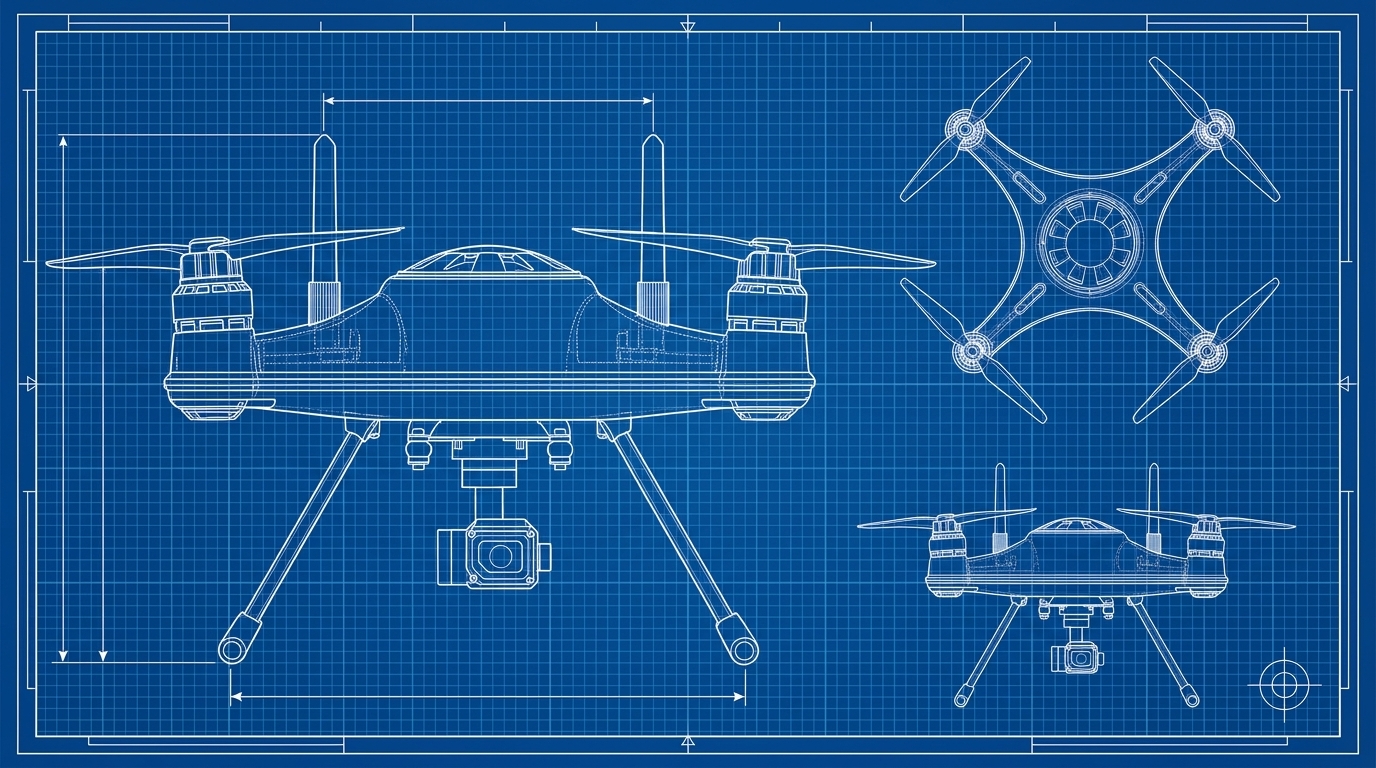
AES Archimedes
- Platform: Small Uncrewed Aerial System (sUAS) / Photogrammetry Drone
- Status: In Development (Seeking Funding Partner)
While the Buttercup operates at the waterline, Archimedes provides the macro perspective. Instead of relying on expensive multispectral or LiDAR cameras that demand specialized computer labs to interpret, Archimedes utilizes high-resolution visual photogrammetry to provide spatial proof of watershed dynamics.
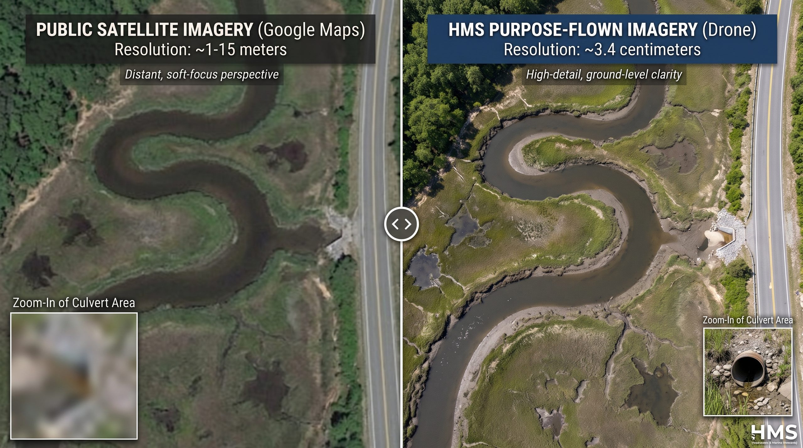
- Purpose-flown Mapping & Imagery: Flies automated grid routes to generate stitched, top-down digital twins. These imagery layers power interactive time-sliders on student Chromebooks to calculate marsh peat slump and river meander migration. Additionally, infrastructure like roads, outfalls, and culverts are captured in high-contrast detail to show human impact on the watershed.
- Outfall & Plume Mapping: Tracks visible sediment plumes, stormwater outfalls, and surface cyanobacteria scums, giving students the aerial evidence they need to correlate with our boat-collected chemistry.
- Riparian Canopy Analysis: Measures tree canopy coverage along riverbanks to quantify shade loss and thermal stress in cold-water habitats.
- Sponsor the Flight: We are actively seeking an equipment sponsor or micro-grant ($1,200) to fund the HPS Sculpin water sonde, field batteries, and ground control gear. Fund this Micro-Grant
3. Subsurface Ops: The Vertical Profiler
HPS Sculpin
- Platform: Handheld Profiling Sonde (Open-Architecture)
- Status: In Prototyping (Seeking Sponsorship)
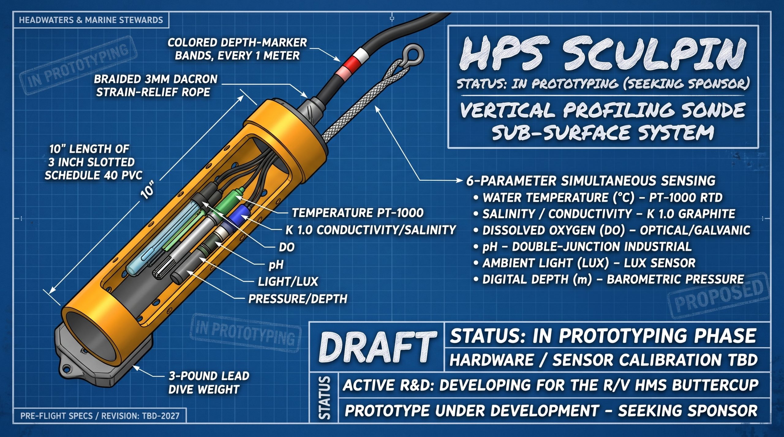
Commercial oceanographic sondes cost upwards of $15,000 and trap data behind proprietary licenses. The HPS Sculpin is our open-architecture alternative: a rugged, PVC-armored instrument package lowered by hand on a marked line to stream depth-stratified data directly to our deck tablets.
- 6-Parameter Simultaneous Profiling: Automatically logs Depth (pressure), Temperature, Salinity/Conductivity, Dissolved Oxygen (DO), pH, and Ambient Light (Lux) on a single vertical descent.
- Automated Salinity Compensation: The onboard microcontroller continuously feeds real-time salinity values into the DO sensor circuit, preventing the measurement errors common in brackish estuaries.
- Curriculum Engine: Supplies the discrete data points required for students to graph lake thermoclines, locate estuarine haloclines, and map deep-water dead zones without manual estimation.
- Sponsor the Build: We are seeking a $1,200 micro-grant to finalize the underwater housing, sensor array, and IP67 deck display unit. Fund this Micro-Grant →
The Fleet Overview
To eliminate reliance on canned datasets and black-box instruments, HMS is actively directing resources and technical development to bring our full three-tier research fleet online:
R/V HMS Buttercup
Active Deployment
Shallow-draft estuarine navigation, culvert sampling, and mobile field lab
sUAS Archimedes
In Development
Seeking Sponsor
Aerial orthomosaics, sediment plume tracking, and canopy mapping
HPS Sculpin
In Prototyping
Seeking Sponsor
Six-parameter vertical profiling sonde (Temp, Salinity, DO, pH, Light, Depth)